|
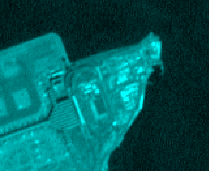
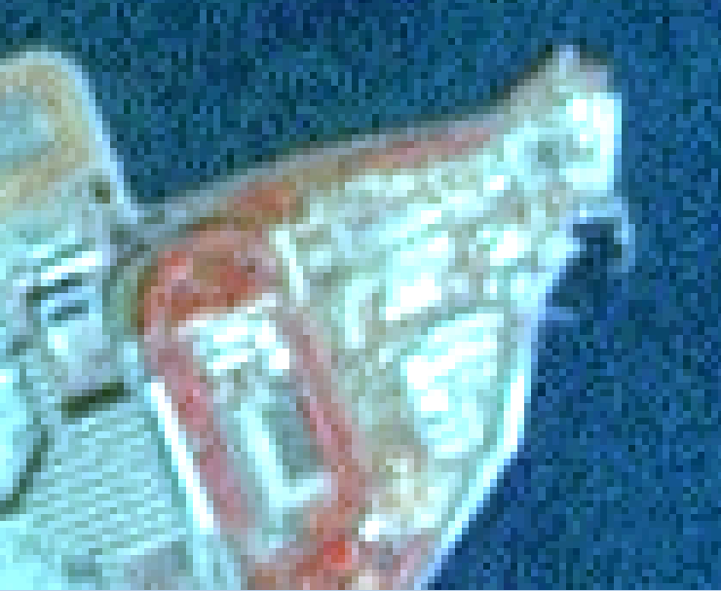
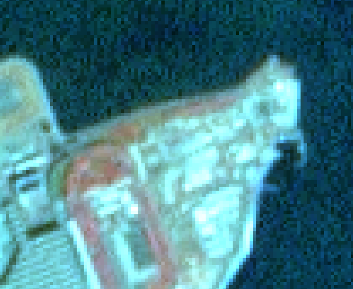
What is data fusion, and What is pansharpening? Data fusion, simply put, is a method of combining different modes of data (whose degrees of heterogeneity can vary) into a single output. While with the purpose of data fusion varies from project to project, the unifying goal is to extract information from the fused result that could not be easily obtained from either source alone. Bear in mind the quote, "The whole is greater than the sum of its parts." Pansharpening is one common method of data fusion. Pansharpening is performed to increase the spatial resolution of remotely sensed imagery by fusing an image's panchromatic band with its multispectral bands. Due to the way in which a sensor captures an image, the panchromatic band always has a higher spatial resolution than its multispectral counterparts. With Landsat images, the panchromatic band has a spatial resolution of 15 meters, while the multispectral bands have a spatial resolution of 30 meters. Why use R for Raster Analysis? Why not use Python or some other software? There is nothing wrong with using Python. You can certainly perform the same tasks in that language. However, performing raster analysis and geoprocessing is not a huge leap away from R's natural ability to work with matrices; R's primary function has traditionally been as a statistical, scientific, and data driven programming language. Since raster data is simply matrix data that has been given geographic context, it should be no surprise that R also works well as an alternative to other raster GIS software like TerrSet, ERDAS, or ENVI. The data and the methods: The R scripts below illustrate some simple pansharpening methods in data fusion. The first attempts to follow the Intensity-Hue-Saturation (IHS) method described in the TerrSet/Idrisi help guide. The other is a Brovey transformation method described in Jixian Zhang's 2010 publication, "Multi-Source Remote Sensing Data Fusion: Status and Trends" in the International Journal of Image and Data Fusion. The sample Landsat data I used can be obtained from: https://clarklabs.org/download/ IHS Transformation
Brovey Transformation
Comparing Outputs:
Works Referenced:
Jixian Zhang (2010) Multi-source remote sensing data fusion: status and trends, International Journal of Image and Data Fusion, 1:1, 5-24, DOI: 10.1080/19479830903561035
3 Comments
|
Jordan Frey#GIS and #DataScience professional. Hiking, cycling, skiing, outdoors and fitness, chess, Star Trek. Works with #rstats #python #SQL #JavaScript etc. Archives
August 2021
Categories |


 RSS Feed